Route estimates arrival times and cuts costs with Radar Geocoding and Distance APIs
Radar’s enterprise-grade, developer-first platform provided the accuracy, reliability, and flexibility Route was looking for in a location infrastructure provider.


$1M
annual cost savings
20%
increase in conversion rates
99.99%
API uptime
The company
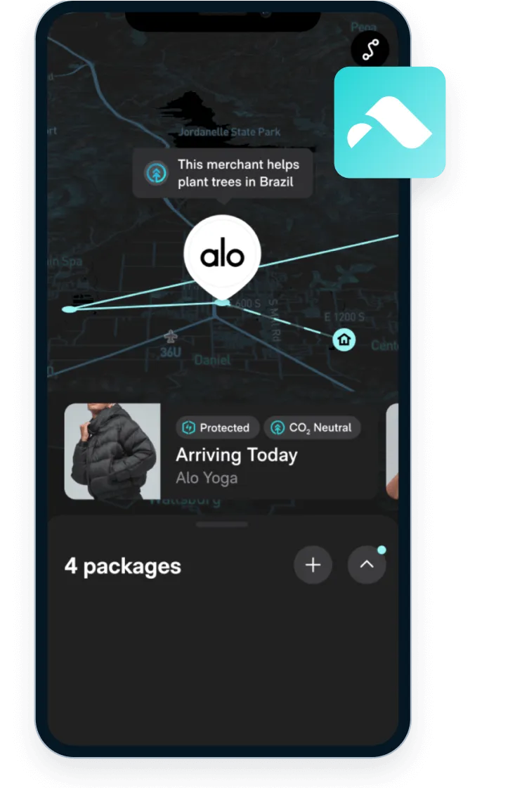
Route is an all-in-one e-commerce platform that helps consumers track all of their packages in a single place. With features like real-time package tracking, delivery ETAs, and carbon neutral shipping, Route helps merchants build trust with their customers, reduce support inquiries, and increase retention. Route uses location infrastructure from Radar to power highly accurate and reliable experiences across its platform.
The challenge
Location is at the core of Route’s business. When setting out to build package tracking, Route’s engineering team knew that accurate geocoding would be essential for their success. Prior to partnering with Radar, Route conducted a thorough evaluation of potential solutions.
To build this in-house, Route estimated that it would require a team of at least 5 full-time engineers and over $1M annually to maintain, excluding the cost of data licenses. Even if they were to rely solely on open datasets, the resource requirements were a dealbreaker. Providers like Google Maps and Mapbox were similarly expensive and too inflexible for Route’s use cases.
Route needed an accurate, cost effective, and extensible solution that could easily integrate with their architecture, which made Radar the best fit.
The solution
Estimating delivery arrival times using geocoding
At each stage of the shipping process, Route receives text-based descriptions of package locations from delivery service providers (DSPs), which can vary in terms of quality and completeness. Radar’s Geocoding API helps Route convert this data into precise geographic coordinates, increasing its utility for many aspects of their business.
One application is Route’s estimated delivery feature. By geocoding tens of millions of historical data points from DSPs, Route built an ML model to reliably predict when packages will arrive at their final destinations based on their current location. When a package location is updated, Route sends the coordinates generated by Radar to its model to determine the ETA, providing customers with unparalleled insight into delivery dates for regular shipments.
Calculating travel distances to provide carbon neutral shipping
In 2022, Route launched Green Package Protection to help neutralize harmful emissions caused by the shipping industry. When customers add Green Package Protection or shop with a participating merchant, Route calculates the carbon emissions from their shipment and neutralizes them with investments in carbon removal projects.
A critical input to this calculation is the travel distance. As an existing Radar customer, Route had a simple solution to a typically complex problem. Using Radar’s Distance API, Route is able to calculate precise travel distances based on the mode of transport and current road networks to make accurate carbon offset investments.
The results
Radar’s enterprise-grade, developer-first platform provided the accuracy, reliability, and flexibility Route was looking for in a location infrastructure provider.
Real-time shipping estimates help Route merchants reduce support queries by 75%, and carbon neutral shipping has proven to increase checkout conversion rates by 20%.
Radar saves Route thousands of engineering hours and over $1M annually to power these features. With 99.99% uptime, Radar is a partner Route can trust with some of its most critical infrastructure.
“Radar’s geolocation services are phenomenal. The data is incredibly accurate and the platform is consistently available. Accuracy and availability are what we value the most in a partner, and we can trust the entire platform. We found that Radar provides the same accuracy as other products on the market at a fraction of the cost. Radar’s APIs are simple to use and easy to integrate, which saved us time and allowed us to dedicate resources to other projects.”
Nick Lloyd
Senior Director of Software Engineering

It's time to build
See what Radar's location and geofencing solutions can do for your business.