Product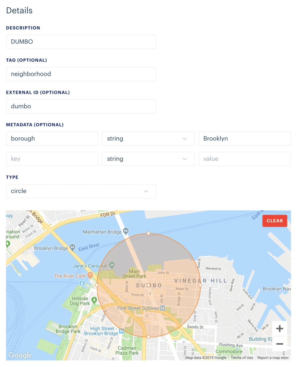
Draw and edit geofences with the new dashboard editor
Radar provides multiple ways to create geofences, including the dashboard, CSV import, the API, and nightly geofence sync.
The dashboard geofence editor is now more powerful, allowing you to draw polygon geofences, set custom geofence metadata, and edit existing geofences.
Feeling artistic? You can start using the new geofence editor today. Just visit the Geofences page and click the New button.
Not a customer yet? Visit our home page to get started!