Real-time location intelligence for every part of your operation
From workforce tracking to delivery ETAs, Radar gives logistics and operations teams complete real-time visibility across every shipment, every route, and every worker, so nothing gets lost between point A and point B.


Everything your logistics operation needs, powered by one location platform
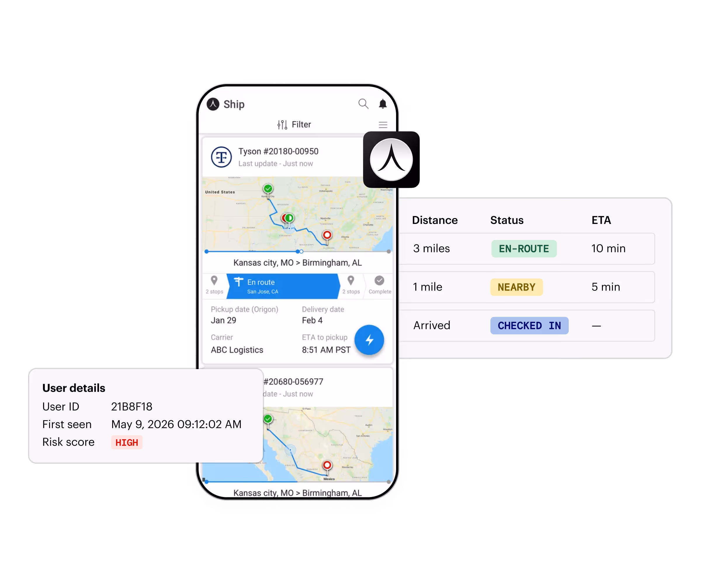
Map every asset, route, and delivery in real time
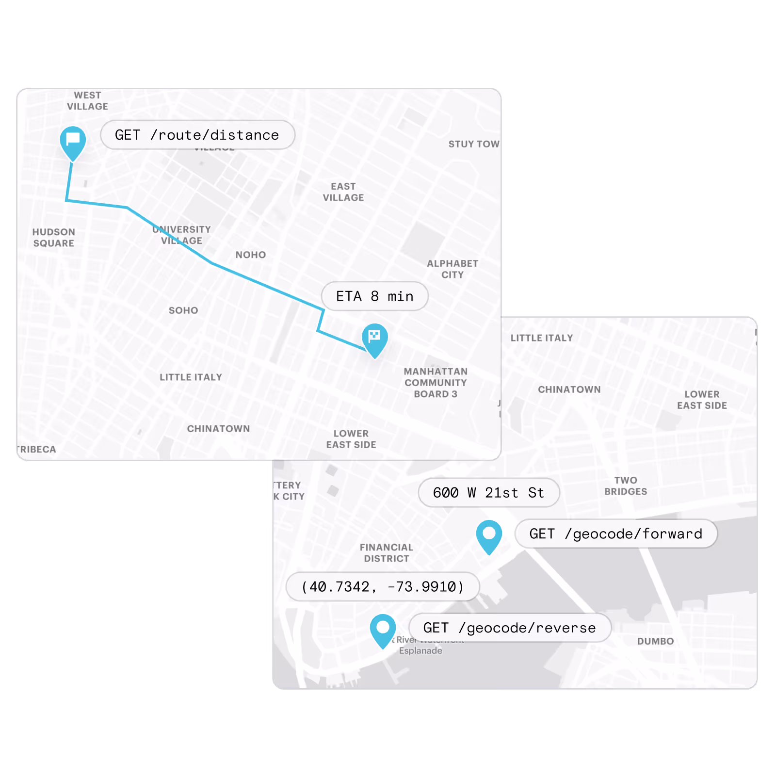
Power fleet maps, route visualization, and location dashboards with customizable maps and geocoding APIs, so operations teams always have the context they need to make faster, smarter decisions.
Explore Maps Platform →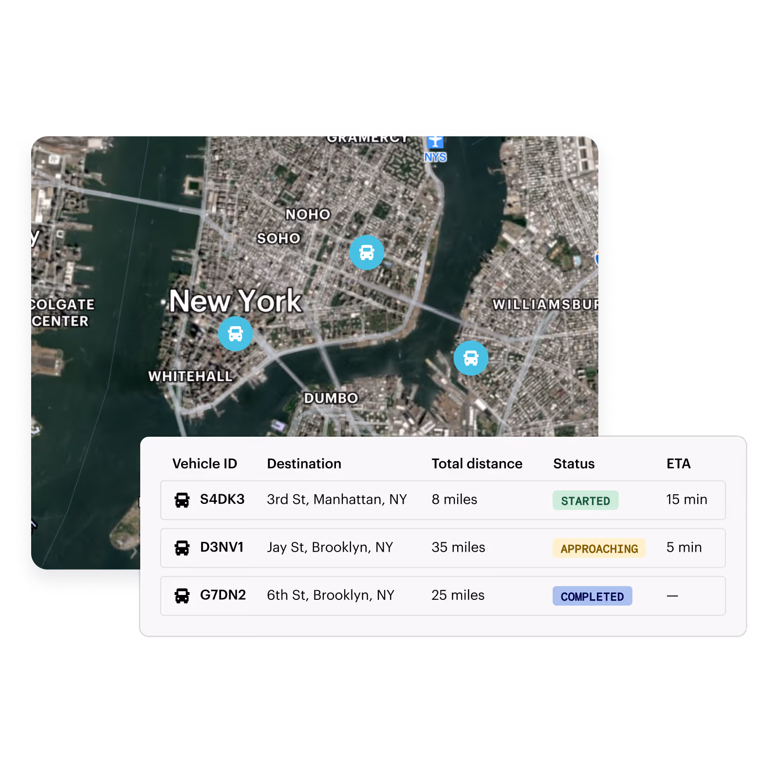
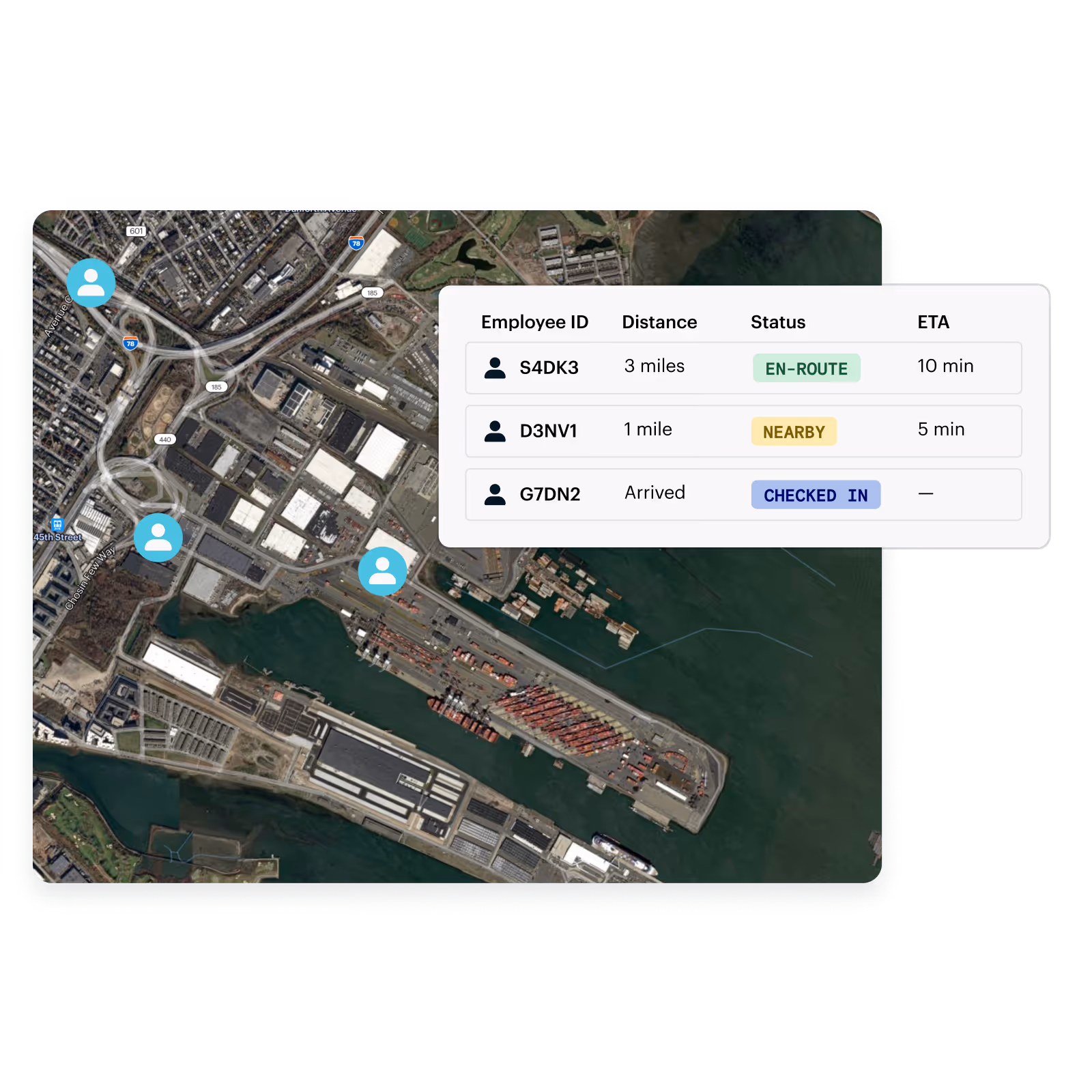
Eliminate the manual steps that slow your operation down
Trigger job starts, status updates, and worker clock-ins automatically when drivers or field workers arrive at or depart from a location, eliminating manual check-ins across your entire network.
Explore Optimize →Trust the location data powering your operations
Detect spoofed locations, fraudulent shift check-ins, and suspicious movement patterns in real time, protecting your operation from bad actors and ensuring your data reflects what’s actually happening in the field.
Explore Protect →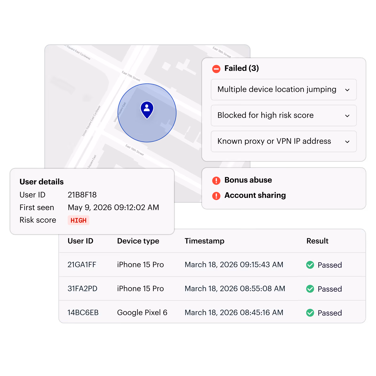
Get every driver to the right place, every time
Power accurate routing, address validation, and distance calculations with enterprise-grade geocoding and routing APIs built to handle the scale and complexity of modern logistics networks.
Explore Maps Platform →Accuracy and reliability you can build your operations on
more tracked trips vs. legacy location vendors
fewer support inquiries from more accurate delivery ETAs
lower no-show rate vs. in-house solution
Trusted by leading logistics companies

”We found that Radar provides the same accuracy as other products on the market at a fraction of the cost. Radar’s APIs are simple to use and easy to integrate, which saved us time and allowed us to dedicate resources to other projects.”

Nick Lloyd
CTO

”When a truck is running late and you don’t know where the driver is, geolocation eliminates the need to make that phone call. You know exactly where the driver is at any point during the lifecycle of the shipment.”

Billy Sarracino
CEO
The proof is in the platform

The most accurate, real-time location data
Radar’s SDKs and APIs collect location, device, and sensor data across GPS, Wi-Fi, IP, and more, giving you the most accurate, real-time signals in the market.

Developer-friendly by design
Modern SDKs and APIs built for fast integration. Connect to your existing stack, integrate with just a few lines of code, and ship in a single sprint.

Enterprise-grade scale and support
1 billion API calls per day and installed on hundreds of millions of devices. SOC 2 and GDPR compliant, backed by a team of location experts who support you at every step.

Cost-effective, all-in-one
Proprietary infrastructure and economies of scale make Radar more cost-effective than legacy solutions or building in-house, so you get more location for less.
Frequently asked questions
How does Radar improve delivery ETA accuracy?

Radar Optimize tracks drivers and shipments in real time using a combination of GPS, Wi-Fi, and cellular signals, then calculates live ETAs based on current location and route. Unlike static estimated windows, Radar’s ETAs update continuously so customers see accurate delivery information right up until the moment the driver arrives. Companies using Radar have seen a 75% reduction in support inquiries related to delivery status, largely because customers no longer need to call to find out where their order is.
Can Radar automate job starts, check-ins, and status updates for field workers?
Yes. Radar’s geofencing platform detects when a driver or field worker arrives at or departs from a location and automatically triggers the corresponding workflow: job start, clock-in, status update, or proof of delivery. This eliminates manual check-ins across your entire network and removes a major source of data entry errors. Companies that have replaced in-house solutions with Radar have reported a 41% reduction in no-show rates and significant operational cost savings. Learn more about Radar Optimize.
How does Radar detect location fraud in logistics operations?
Radar Protect flags spoofed GPS signals, fraudulent shift check-ins, and suspicious movement patterns in real time. This is particularly valuable for gig and contract workforce models where operators can’t physically verify a worker’s location. Radar cross-references multiple location signals and device signals to identify when a reported location doesn’t match what the device is actually doing, giving operations teams confidence that the data driving their workflows is accurate.
What is GPS spoofing, and how does Radar detect it?
GPS spoofing is when a device broadcasts a falsified location signal to make it appear somewhere it isn't. In logistics and workforce management, this is most commonly used by drivers or workers to fake a delivery confirmation, clock in from a job site they're not at, or manipulate route data. The consequences range from payroll fraud and missed deliveries to compliance exposure and disputed invoices. Radar Protect detects spoofing in real time using a combination of location signals so you know when a reported location doesn't match where someone actually is before it becomes a problem.
Does Radar support both mobile and web tracking for drivers?
Yes. Radar’s SDK is available for iOS, Android, and web, making it suitable for operations that use native apps, progressive web apps, or web-based dispatch portals. For fleets using dedicated hardware, Radar’s APIs can integrate with third-party tracking devices as well. See the full list of supported integrations on the integrations page.
How does Radar’s routing and geocoding support last-mile delivery accuracy?
Radar’s geocoding APIs translate addresses into precise coordinates and validate that addresses exist before a driver ever leaves the depot. Routing APIs calculate optimal routes and distance matrices at scale. Together, these tools reduce failed deliveries caused by bad addresses, improve route efficiency, and give dispatchers the data they need to manage by exception. Learn more about Radar Maps Platform.
How long does it take to integrate Radar into a logistics operation?
Most teams are up and running in a single sprint. Radar’s developer-friendly SDKs, open documentation, and pre-built integrations reduce the custom work required. See Radar’s developer docs and the integrations page to get a sense of what’s available. And because Radar is a unified platform rather than multiple point solutions, you only need one integration to cover tracking, geofencing, geocoding, and fraud detection. See how Milk Moovement and Route made the switch.